
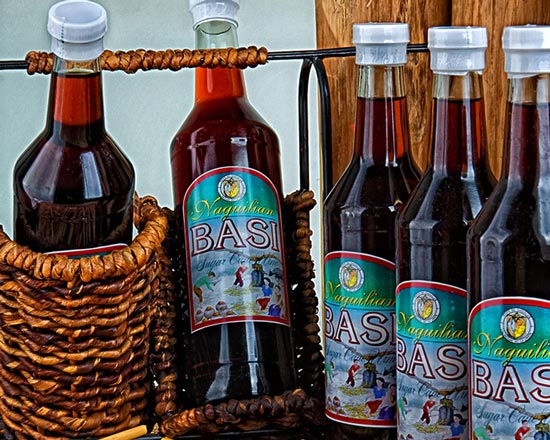
BASI
Site Classification: Man Made
Level of Development: Under Developed
Location: Brgy. Cabaritan Sur
Access Road: Fontanos Road leading to Brgy. Cabaritan Sur
Distance from Municipal Hall: 2.65 km
Description: A one-stop-shop for agricultural services, this 2.1 hectare lot at Barangay Cabaritan Sur houses the Basi and Vinegar Processing Center, the National Food Authority Warehouse, the Naguilian Slaughterhouse, the Organic Demonstration and Training Farm, and the Multi-Story Cropping Project of the municipality.

San Antonio Mini Rice Terraces
Site Classification: Natural
Level of Development: Underdeveloped
Location: Brgy. San Antonio
Access Road: Naguilian-Bagulin Road, Tuddingan – San Antonio Rd., San Antonio- Bimmotobot Road, Allangigan Road
Distance from Municipal Hall: 19.6 kms
Description: The San Antonio Mini Rice Terraces were carved from mountain slope by the local residents. The rice paddies are fed by mountain stream that channels into an irrigation canal that runs downhill through the terraces. The place is very accessible through public utility vehicles such as jeepney.
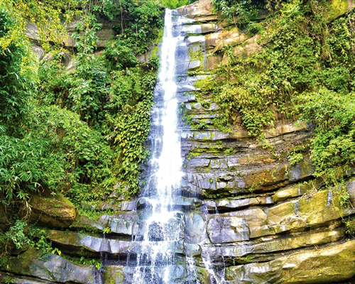
Tuddingan Falls
Site Classification: Natural
Level of Development: Emerging
Location: Brgy. Tuddingan
Access Road: Naguilian-Bagulin Road – Tuddingan Farm to Market Road
Distance from Municipal Hall: 6.9 km
Description: With its waters flowing from atop the mountains, Burayok Falls, as formerly called by the local residents is approximately seven kilometers away from the town proper, with a 200-meter hike in a trail lined with trees and shrubs.
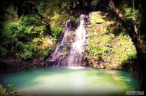
Sangbay Falls
Site Classification: Natural
Level of Development: Emerging
Location: Brgy. Gusing Sur (Arellano St.)
Access Road: Naguilian-Baguin Provincial Road
Distance from Municipal Hall: 4.42 km
Description: It is believed to have offered protection as well as a source of water and food for the revolutionaries during World War II. At present, the site has retained its natural and pristine beauty. It requires one to two hours of trekking from Barangay Gusing Sur.

Daughters of Mary Consolatrix
Site Classification: Man Made
Level of Development: Underdeveloped
Location: Town Proper
Access Road: National Highway
Distance from Municipal Hall: 0.3 km
Description: Known as the decade of intense activism in the Philippines, the 1970’s gave birth to the Daughters of Mary Consolatrix Monastery through the initiative of Mother Marie Alexis de Jesus Pacis from the Sisters of St. Paul de Chartres. Witnessed to a life of prayer and penance, they emphasized the importance of the Holy Mass and love for Jesus in the Eucharist. Moreover, they also taught that true discipleship is best achieved through devotion to Mary, the most perfect of Jesus’ disciples. It offers the most serene place to meditate, relax and retreat away from the plight of everyday life.

Casilagan Watershed Area
Site Classification: Natural
Level of Development: Underdeveloped
Location: Brgy. Casilagan (Gatling Rd., Daplis Rd.)
Access Road: Naguilian-Baguin Provincial Road
Distance from Municipal Hall: 5.82 km
Description: The Naguilian Watershed Forest Reserve was established by virtue of Presidential Proclamation No. 52 dated April 11, 1936; approximately 89.9540 hectares of land located at Barangay Casilagan became an initial component of the National Integrated Protected Areas System (NIPAS) Law of 1992. Characterized as undulating to moderately rolling uplands with rugged hills and mountainous terrain, it is a home to various flora and fauna found in the municipality.
