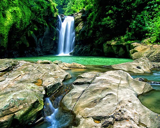
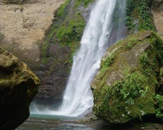
Balay Anito Falls
Site Classification: Natural
Level of Development: Major Destination
Location: Brgy. Lettac Sur
Access Road: Balaoan-Santol Road leading to Brgy. Lettac Sur
Distance from Municipal Hall: 6.35 km
Description: “Balay Anito” means house of unseen friends or Anitos. It cascades to a very deep water called “ban-aw” which is about 20 meters deep. The sides are so steep that one has to cling to the exposed roots of trees along the precipice in order to get down.
Puy-Ocan Falls
Site Classification: Natural
Location: Barangay Sapdaan
Level of Development: Underdeveloped
Access Road: Balaoan-Santol Road, from Poblacion leading to Mangaan-Ramot leading to Brgy. Sapdaan
Distance from Municipal Hall: 16.6 km
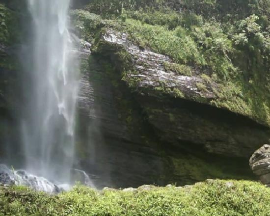
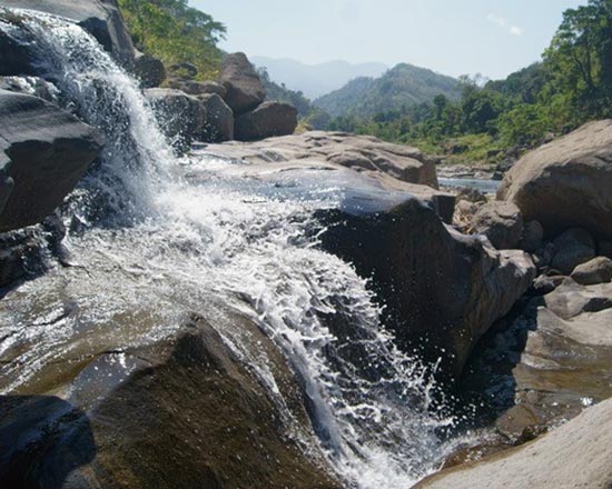
Description: Puy-ocan falls is a new attraction in the Municipality. It is described as a “Mist Falls” due to the misty run of the falls hitting the rocks below. One of the farthest sites in the Municipality, it is only visited by pro-trekkers.
Simminublan Falls
Site Classification: Natural
Location: Barangay Puguil
Level of Development: Emerging Tourist Destination
Access Road: Balaoan-Santol Road to Osias Street Leading to Sitio Bilagan Brgy. Puguil
Distance from Municipal Hall: 5.08 km
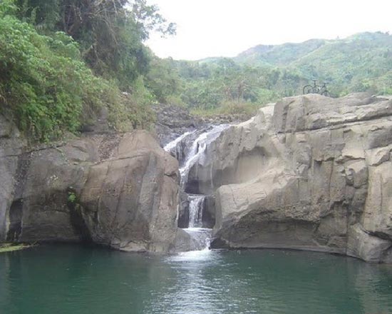
Description: Simminublan Falls is shaped like a palayok or pot. This pool obtains its water supply from the mountains which cools weary and tired adventurers.
Pimmalangka Falls
Site Classification: Natural
Location: Barangay Ramot
Level of Development: Underdeveloped
Access Road: Balaoan-Santol Road to Poblacion-Mangaan Road leading Sitio Letang, Brgy. Ramot
Distance from Municipal Hall: 10.9 km
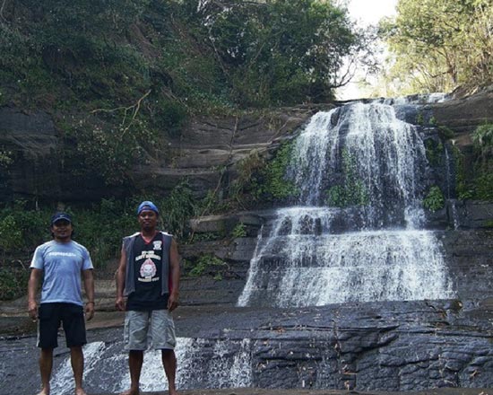
Description: Pimmalangka Falls is a new tourist spot in the Municipality which the LGU is presently developing.
Lengsad Falls
Site Classification: Natural
Location: Barangay Tubaday
Level of Development: Underdeveloped
Access Road: Balaoan-Santol Road to Sitio Palayen, Brgy. Tubaday leading to Amburayan River
Distance from Municipal Hall: 18.5 km
Description: This is a newly discovered site in the municipality. The falls is ideal for professional trekkers.
Bulalakaw Falls
Site Classification: Natural
Location: Barangay Ramot
Level of Development: Underdeveloped
Access Road: Balaoan-Santol Road to Poblacion-Mangaan Road leading Sitio Letang, Brgy. Ramot
Distance from Municipal Hall: 8.33 km
Description: The Bulalakaw Waterfalls is a newly discovered waterfalls situated just next to the Pimmalangka Falls. It is considered as a new tourism site in the locality.

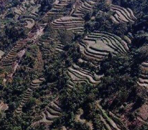
Sasaba Rice Terraces
Site Classification: Natural
Location: Barangay Ramot
Level of Development: Emerging Tourist Destination
Access Road: Balaoan-santol Road to Poblacion-Mangaan leading to Brgy. Ramot Tramline Section
Distance from Municipal Hall: 11.59 km
Description: There is no written documentation as to how the site was discovered, developed, etc.

Meditation Cross
Site Classification: Pilgrimage
Location: Barangay Poblacion
Level of Development: Emerging Tourist Destination
Access Road: Balaoan-Santol Road leading to Sitio Lettac, Brgy. Poblacion
Distance from Municipal Hall: 750m
Description: The Meditation Cross is one of the tallest cross in the entire province. The cross is used as the last station during the holy week celebration in the municipality.
Pisnadan Rice Terraces
Site Classification: Natural
Location: Barangay Tubaday
Level of Development: Underdeveloped
Access Road: Balaoan-Santol Road leading to Brgy. Ramot-Puguil Road Sitio Pisnadan, Brgy. Tubaday
Distance from Municipal Hall:
Description: There is no written documentation as to how the site was discovered, developed, etc.
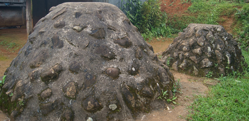
Gongo
Site Classification: Cultural
Location: Barangay Puguil
Level of Development: Underdeveloped
Access Road: Balaoan-Santol Road, from Poblacion leading to Mangaan-Ramot Road leading to Sitio Liguay, Brgy. Puguil
Distance from Municipal Hall: 18.1 km
Description: “Gongo” is the native term for tomb. The Bago people of Puguil, buried their ancestors in their backyard in a sitting position beneath a pile of stones.