
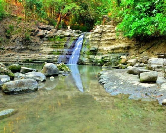
Ukkalong Falls
Site Classification: Natural
Location: Brgy. Cabalitocan
Access Road: Brgy. Cabalitocan Road
Distance from Municipal Hall: 7.09 kms
Description: During the Spanish Time, the place served as a hide out for the natives to avoid harm and danger. Today, it is considered as a suitable venue for camping, mountain climbing, hiking, and trekking. It became popular during the 1960s. The calm and fresh water from the falls to its basin is good for diving and bathing.
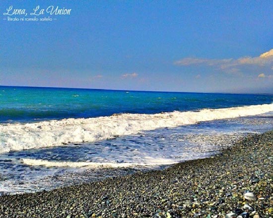
Pebble Beaches
Site Classification: Natural
Location: Barangay Victoria, Magallanes, Barrientos and Nalvo Norte
Access Road: Bacnotan-Luna-Balaoan Road
Level of Development: Major Tourist Site
Distance from Municipal Hall: 0.83kms – 3.31 kms
Description: Discover the mystery this beach holds. The colourful pebbles that adorn this shore are believed to be a gift from heaven and the unending supply of these has become a source of livelihood of the locals.
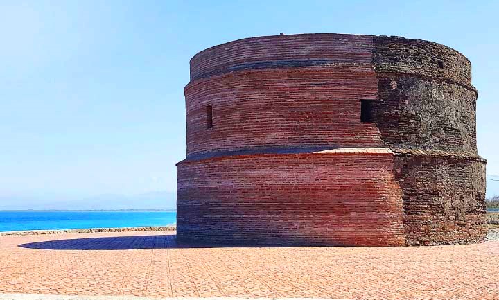
Baluarte Watch Tower
Site Classification: Historical
Location: Barangay Victoria
Access Road: Namacpacan Road- Valdez Street – Victoria Beach Road
Level of Development: Major Tourist Site
Distance from Municipal Hall: 0.83 kms
Description: Baluarte stands in disarray, vertically cut in two because of eroded base and foundation, its two halves stand through concrete post supports on its sides. Like an old wounded soldier, it still stands in the pebble beaches of Luna, watching its industrious stone pickers finding a way for survival amidst the scorching hot sun. Time will come when this historic landmark will be finally and totally washed ashore, but the Baluarte which saw the Luna brothers grew, will continue to be a representation of the people of Luna, strong and united like its cemented bricks. It was recently rehabilitated by the LGU with assistance from the National Historic Institute.
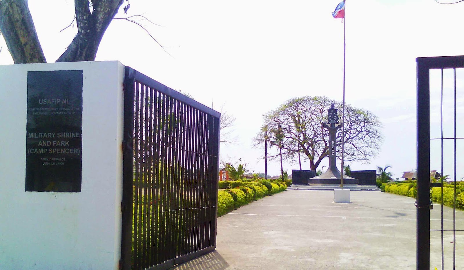
Camp USAFIP
Site Classification: Historical
Location: Barangay Darigayos
Access Road: Bacnotan – Luna Road
Level of Development: Major Tourist Site
Distance from Municipal Hall: 7.05 kms
Description: This camp is named in honor of Private Grafton Spencer of the Australian Army who was killed in action early 1943. This camp was deactivated on orders of the Philippine Army on December 1946. It is preserved as a military shrine and park by virtue of Proclamation 590 signed by President Fidel V. Ramos on June 1,1995. This park is a wartime General Headquarters of the USAFIP NL. The park also features a Memorial Wall where the names of the 1,437 US State Army of the Philippines, Guerrillas, and Soldiers are inscribed in honor of their service during the battle of Bessang Pass.

Kamay na Bato
Site Classification: Man Made
Location: Brgy. Nalvo Norte
Access Road: Bacnotan – Luna – Balaoan Road – Nalvo Norte Barangay Road
Level of Development: Major Tourist Site
Distance from Municipal Hall: 3.31 kms
Description: The tourism site is located along the coastal area and features the works of Mr. Kim, the stone sculptor. It is made of cobble stones, pebbles and decorated with antique works and furniture to make it more unique to look at. Stone carvings with different designs are also available in the place.

Shrine of Our Lady of Namacpacan
Site Classification: Pilgrimage
Location: Town Proper
Access Road: Processional Road
Level of Development: Major Tourist Site
Distance from Municipal Hall: 230m
Description: The century old church of the St. Catherine de Alexandria is found in the town of Luna. It is formerly called Namacpacan due to the local people’s impressive hospitality to visitors. The shrine houses the miraculous image of Our Lady of Namacpacan and has a splendid white, pale grey, and light blue facet and has preserved its original walls crafted from century old bricks and stones.
